


PRECINCT EMERSON, Jefferson County, Ohio
About
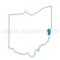
Outline

Summary
| Unique Area Identifier | 648160 |
| Name | PRECINCT EMERSON |
| County | Jefferson County |
| State | Ohio |
| Area (square miles) | 12.70 |
| Land Area (square miles) | 12.70 |
| Water Area (square miles) | 0.00 |
| % of Land Area | 99.99 |
| % of Water Area | 0.01 |
| Latitude of the Internal Point | 40.17173400 |
| Longtitude of the Internal Point | -80.84276490 |
Maps


Graphs
Select a template below for downloading or customizing gragh for PRECINCT EMERSON, Jefferson County, Ohio


Neighbors
Neighoring Voting District (by Name) Neighboring Voting District on the Map
- Voting District COLERAIN TWP 1, Belmont County, OH
- Voting District COLERAIN TWP 2, Belmont County, OH
- Voting District COLERAIN TWP 3, Belmont County, OH
- Voting District FAIRPOINT, Belmont County, OH
- Voting District PEASE 1, Belmont County, OH
- PRECINCT CONNORVILLE, Jefferson County, OH
- PRECINCT GLEN ROBBINS, Jefferson County, OH
- PRECINCT HANNA, Jefferson County, OH
- PRECINCT MT PLEASANT, Jefferson County, OH
- PRECINCT PINEY FORK, Jefferson County, OH
- PRECINCT SHORTCREEK TWP/VIL, Harrison County, OH
Top 10 Neighboring County Subdivision (by Population) Neighboring County Subdivision on the Map
- Pease township, Belmont County, OH (14,309)
- Colerain township, Belmont County, OH (4,276)
- Warren township, Jefferson County, OH (4,232)
- Smithfield township, Jefferson County, OH (3,473)
- Mount Pleasant township, Jefferson County, OH (2,368)
- Wheeling township, Belmont County, OH (1,691)
- Short Creek township, Harrison County, OH (1,090)
Top 10 Neighboring Place (by Population) Neighboring Place on the Map
Top 10 Neighboring Unified School District (by Population) Neighboring Unified School District on the Map
- St. Clairsville-Richland City School District, OH (16,465)
- Buckeye Local School District, OH (15,250)
- Martins Ferry City School District, OH (10,264)
Top 10 Neighboring State Legislative District Lower Chamber (by Population) Neighboring State Legislative District Lower Chamber on the Map
Top 10 Neighboring State Legislative District Upper Chamber (by Population) Neighboring State Legislative District Upper Chamber on the Map
Top 10 Neighboring 111th Congressional District (by Population) Neighboring 111th Congressional District on the Map
Top 10 Neighboring Census Tract (by Population) Neighboring Census Tract on the Map
- Census Tract 101, Belmont County, OH (4,264)
- Census Tract 106, Belmont County, OH (3,712)
- Census Tract 103, Belmont County, OH (3,425)
- Census Tract 121, Jefferson County, OH (2,836)
- Census Tract 9759, Harrison County, OH (2,280)
- Census Tract 122, Jefferson County, OH (2,175)
Top 10 Neighboring 5-Digit ZIP Code Tabulation Area (by Population) Neighboring 5-Digit ZIP Code Tabulation Area on the Map
- 43950, OH (16,762)
- 43935, OH (8,943)
- 43907, OH (6,008)
- 43943, OH (3,472)
- 43917, OH (3,136)
- 43901, OH (2,219)
- 43939, OH (513)